[slideshow_deploy id=’423′]
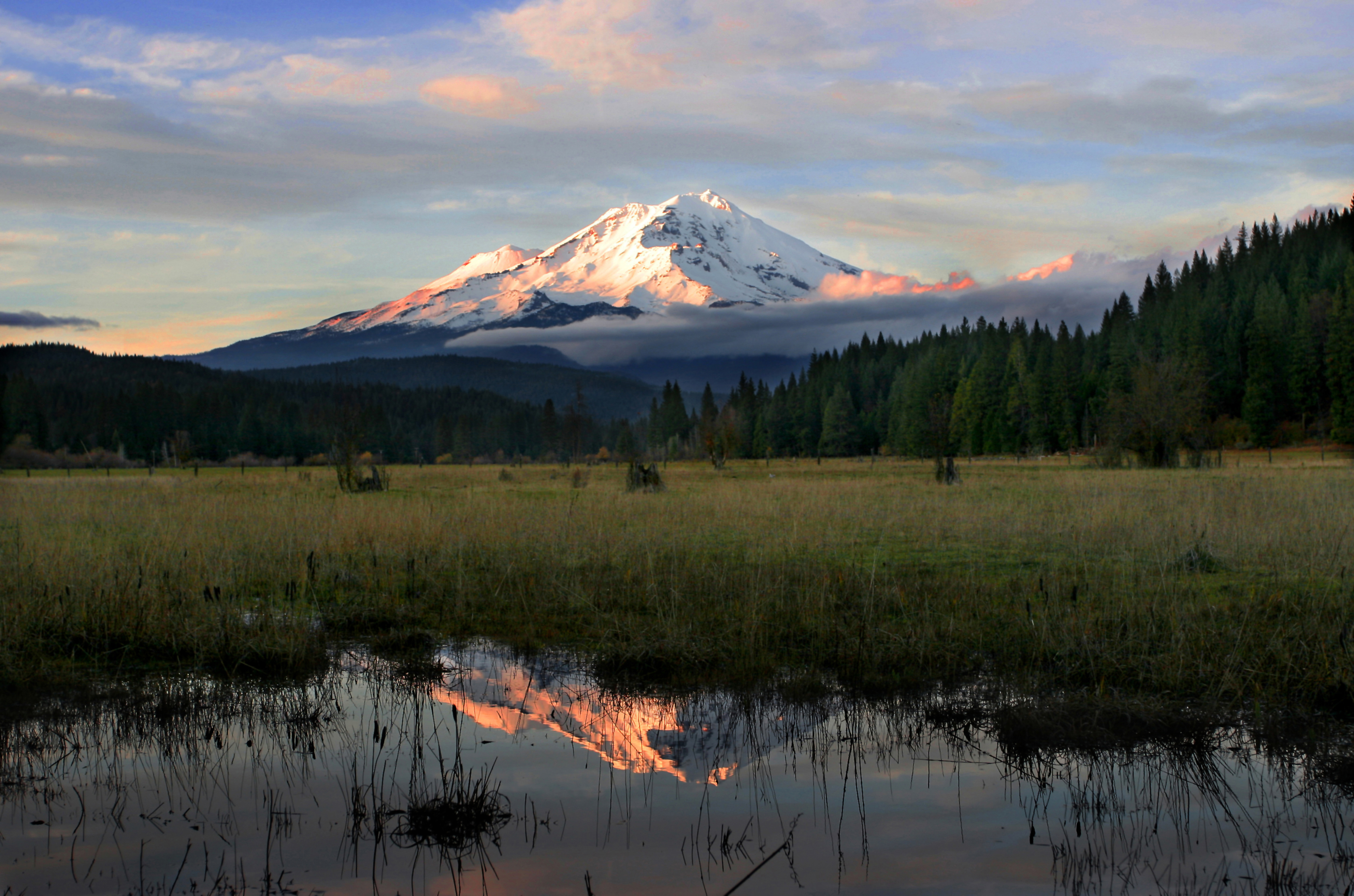
Mt. Shasta, 14,162 feet, in Northern California is situated in the largest zone of volcanoes in the world, the Pacific Ring of Fire. 75% of the world’s volcanoes lay along this ring, which stretches from Alaska to South America, circles the Pacific Ocean heading north through Japan and back over to Alaska. Mt. Shasta is in a section called the Cascade Range, which begins where the Sierra Nevadas end — extending 700 miles up through Northern California, Oregon, Washington and into southern British Columbia. There are 19 major volcanoes in the Cascade Range. Mt. Rainier, in Washington, is the tallest at 14,411 feet. Mt. Shasta, the second tallest volcano in the lower 48 states is 249 feet below Rainier, but is more massive. I climbed with a few members of The Arizona Mountaineering Club and it was my first alpine ascent wearing crampons and using an ice axe. We began at the Bunny Flat trailhead and then scaled Avalanche Gulch route to the summit – 6 vertical miles, with an elevation gain of 7,000 feet. The two Spring days — not a cloud in the sky and so warm, stood on the summit in a t-shirt! Also, came away from the climb with severe sunburn on my face; and while doubled over, sucking wind on the steep slopes — reflected radiation from the snow fried the roof of my mouth. For a week after, back home, only thing I could eat was Gerber’s baby food – “Banana Mush,” my all-time favorite flavor!
Leave a Reply